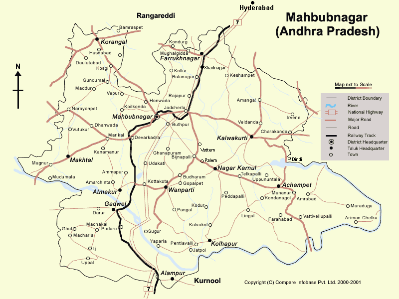
Mahabubnagar Roadmap
Major Roads in Mahabubnagar district are
-
National Highway-NH7,
-
Srisailam State highway (Hyderabad to Srisailam)
-
District Highway network - Kodangal, Narayanpet, Makhtal, Kalwakurthi, Nagar kurnool, Achampet, Wanaprthi, Shad nagar, Kotha kota, Gadwal and Alampur are well connected by Road.
The Andhra Pradesh Government has initiated a programme to double the road network in the State from the present 1.98 lakh km. Also, it proposes to develop five high-density corridors through private participation, covering a total of 1,295 km. These corridors include the stretches of: Hyderabad-Vijaywada-Machillipatnam (330 km), Hyderabad-Kurnool-Anantapur-Penugonda (440 km) and Nalgonda-Mahaboobnagar-Raichur (175 km). The total investment for developing the five corridors is estimated at $1,290 million.
Another proposed project:
DEVARAKONDA - JADCHERLA - MAHABOOBNAGAR -
TANDUR ROAD
Length of Project ... 197 kms
Traffic Volume ... 13000 to 16000 PCU
Cost of the Project ... US $ 17 million ( Rs.800 million ) 17